

The Volcano
The Missing Ash
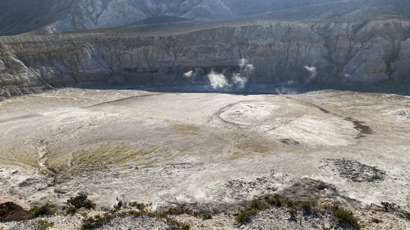
Some fifteen kilometres south-east of Nisyros, a sediment core taken from the seabed revealed traces of four volcanic eruptions. Only two of these had previously been identified on the island: the eruption that produced the so-called Lower Pumice, around 76,000 years ago, and the one responsible for the Upper Pumice, approximately 57,000 years ago. No corresponding deposits from the other two had been found on land.
The most recent of the four eruptions had scattered ash as far as three hundred kilometres away, across the northern Aegean. Its traces have been identified in thirteen marine sediment cores. The earliest eruption, meanwhile, had left a layer of ash more than twenty centimetres thick in sediments south of Nisyros.
Between these two major eruptions, the seabed had recorded two others, occurring approximately 69,000 and 63,000 years ago. In the same core, they were represented by layers of ash just four and three centimetres thick, separated by sediments accumulated over thousands of years. The distinct chemical signatures of the tiny shards of volcanic glass made it possible to identify them as the remains of two separate eruptions.
On the island, the ash may have been swept away by erosion, buried beneath later deposits or altered beyond recognition. It may still lie somewhere in unexplored strata. On the seabed, however, the layers had remained interleaved with other sediments, preserving a sequence no longer discernible on the volcano itself.
When the findings were published in 2021, these two thin layers added two previously unrecognised episodes to the eruptive history of Nisyros. Together, they amounted to just seven centimetres of ash, yet some six thousand years separated them.
The Earth Held Aloft
On a fifth-century BC Attic vase, now in the Kunsthistorisches Museum in Vienna, Poseidon holds an enormous piece of land aloft. He is about to hurl it at a giant, but the rock still carries the creatures that inhabited it: a dolphin, an octopus, a scorpion, a millipede, an ibex and several snakes. Sea creatures and land animals share the same fragment of the world, torn from its original place and suspended in the instant before it falls.
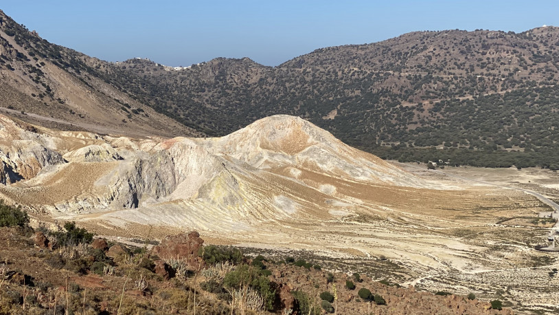
According to one version of the Gigantomachy, Poseidon pursued Polybotes across the sea to Kos. To stop him, he tore a piece of the island away with his trident and hurled it at the giant. The mass of land became Nisyros, burying Polybotes alive.
The fall of the rock did not end the struggle. Polybotes remained trapped beneath the weight of the island, still able to stir and press against the earth above him. Whenever Nisyros trembled, people imagined him struggling to break free; whenever a rumbling rose from underground, they imagined him striking once more against his prison. The tremors, sulphurous vapours and sounds rising from the volcano's inaccessible depths seemed to prolong his struggle.
Meanwhile, the giant's identity shifted from one image to another. The museum in Vienna identifies the painted figure as Ephialtes, not Polybotes. His eyes, depicted without irises or pupils, allude to the arrows with which Apollo and Heracles had already blinded him. On another Attic cup, painted several decades later, Gaia emerges waist-high from the ground and reaches towards Poseidon, pleading with him to spare her son.
Even the place of his burial was uncertain. Strabo recounts how Nisyros was formed from the fragment of Kos hurled by Poseidon, but also records another tradition in which Polybotes remains buried beneath Kos.
On the south-eastern coast of Kos, near Mount Zini, the remains of a vast landslide can still be found. Enormous masses of rock fell from the mountainside towards the sea. Nearby, possible marine deposits containing microscopic fossils from marshland environments have been identified up to seven metres above sea level. Other large boulders lie stranded along opposite stretches of coastline, perhaps carried there by a tsunami triggered by the collapse.
In 2022, three geologists considered whether this event might have contributed to the story of Poseidon's struggle with Polybotes. Unable to date the landslide directly, they also looked to the earliest depictions of the myth, which appear on Greek pottery from the middle of the sixth century BC. The memory of a catastrophe on Kos may have become entwined with the volcanic phenomena of Nisyros, although the connection remains uncertain.
The Two Lakes
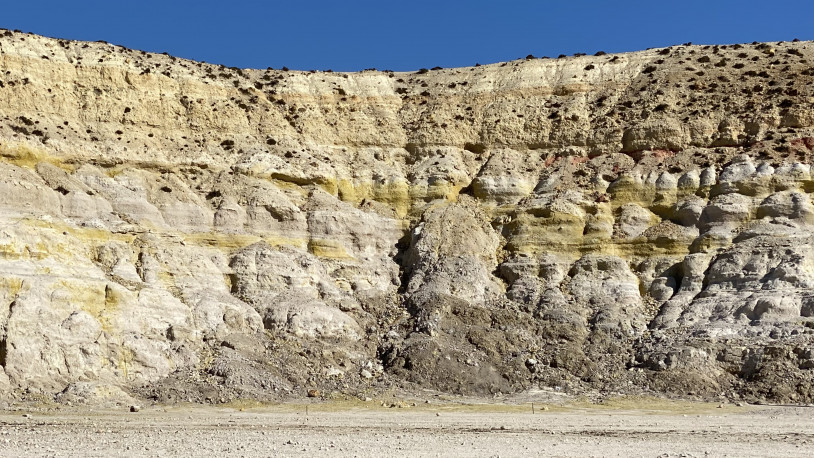
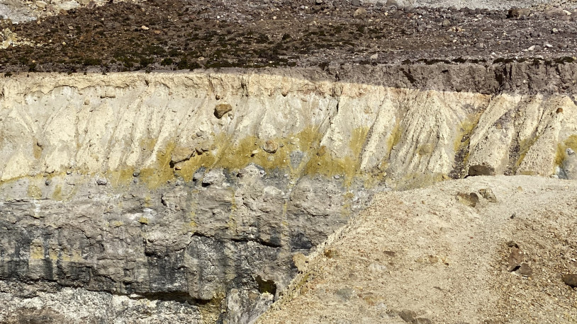
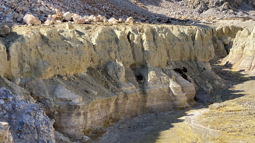
Two names appear on the geological map of Nisyros: First Lake and Second Lake. Neither lake exists any longer. Their ancient beds are exposed along the north-eastern edge of the caldera, where exceptionally thin black layers, rich in manganese and in places only a few millimetres thick, can be distinguished among the ash and volcanic sand.
In one of these lakes, a lava flow reached the lake bed while the sediments were still saturated with water. Under the weight of the lava, they sagged and buckled, forming a series of irregular structures known to geologists as load casts. As the lava cooled and hardened, these deformations were preserved. Later, new lake sediments began to accumulate over its solidified surface.
We do not know whether water had returned to the same depression or whether another lake had formed. Traces of both are now exposed in the caldera wall, where the ancient lake beds can be seen in cross-section.
The Empty Bottle
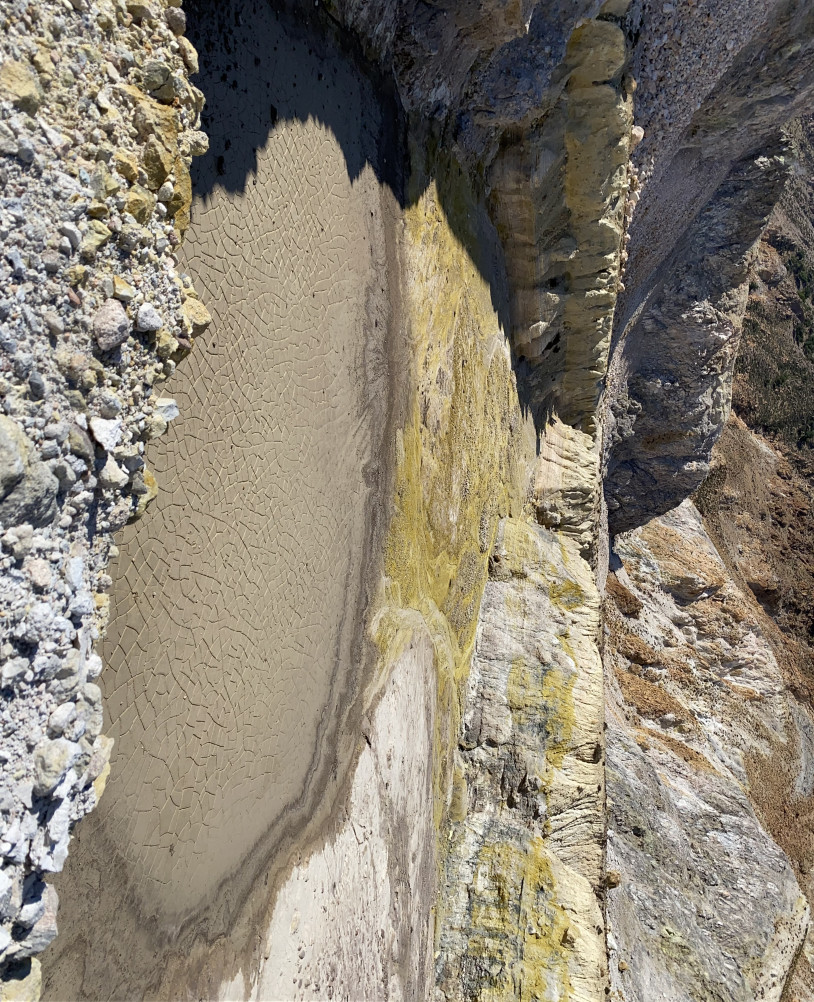
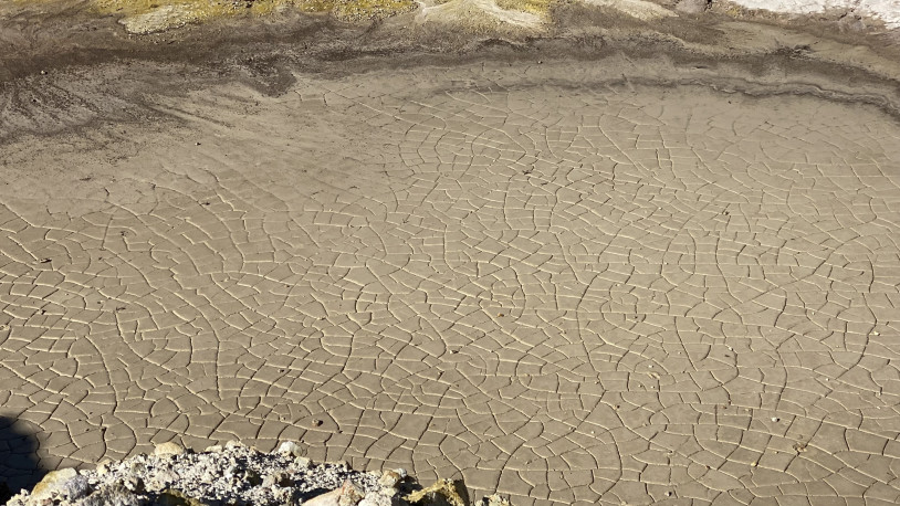
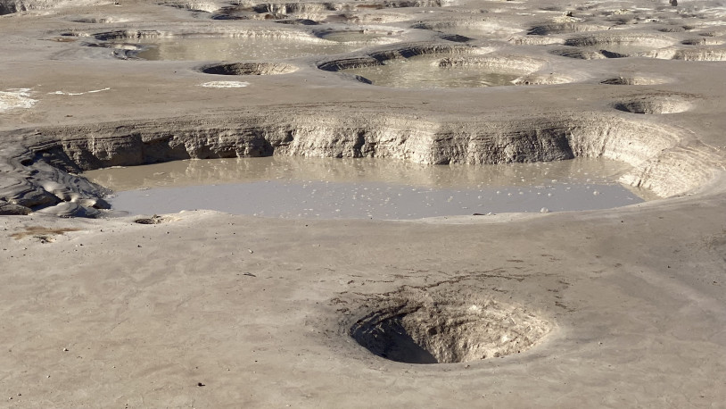
In August 1841, Ludwig Ross descended into the caldera of Nisyros carrying a bottle. He had been told that sulphurous water collected in hollows on the crater floor, sometimes remaining there even through the summer months. He wanted to take a sample away with him.
Instead, he found the ground dry. For some fifty paces he heard small explosions beneath the surface, one every twenty or thirty seconds. The smell of sulphur reached as far as Nikia, and the inhabitants told him that after rain, steam poured more thickly from the fissures, accompanied by rumblings audible from a considerable distance.
Ross found the places where the water should have collected. But the summer heat had dried up even the smallest pools. Beneath his feet, the ground continued to produce regular bursts of sound; in the hollows, there was no longer enough water to collect.
The bottle remained empty.
Wooden Shoes
Halfway up the volcano on Nisyros, according to Cristoforo Buondelmonti, travellers had to change their shoes. The ground grew so hot that no one could continue without wooden footwear.
The Florentine traveller, who journeyed through the Aegean in the early fifteenth century, described a mountain from which sulphurous vapours escaped day and night. It reminded him of Stromboli and Lipari. The islanders collected the sulphur that emerged from the ground and sold it to passing merchants.
Just below the summit, Buondelmonti described a hot spring whose waters flowed towards a deep, dark lake in the plain below. In his account, the mountain gave off smoke and vapour, hot water flowed downhill, and the higher one climbed, the more difficult the ground became to cross.
Buondelmonti left no description of the shoes themselves. They may have been clogs, or shoes fitted with thick wooden soles. He does not say who made them, nor whether they belonged to the islanders who regularly ventured onto the mountain to collect sulphur.
In his Liber insularum Archipelagi, he depicted Nisyros with its smoking mountain. The wooden shoes do not appear on the map.
The Dust That Vanished
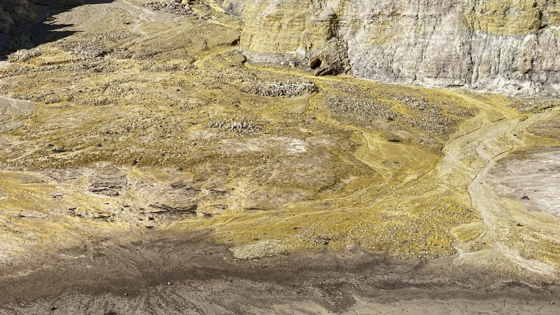
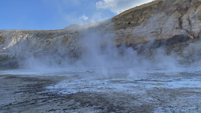
In November 1871, Nisyros was shaken by a succession of violent tremors. Thunder-like detonations came from beneath the ground, while red and yellow flashes lit the sky above the caldera. Fragments of rock were hurled into the air, and new fumarolic vents opened in the earth. When the explosions ceased, the fields below the crater were covered in white dust.
More than a century later, in 1993, geologists searching the caldera deposits for traces of those explosions found no layer that could be attributed with certainty to the events of 1871. The dust may have been carried away by erosion, swept down by subsequent mudflows or mixed with material from later eruptions. Even its precise composition remains unknown.
Henri Gorceix, who studied the volcanic activity of the nineteenth century, left his name on the geological maps of Nisyros. It still designates a group of recent hydrothermal deposits, not all of which can be linked with the events he documented.
In June 1873, further explosions hurled boiling water, dark mud and fragments of rock into the air, sending material down the slopes towards the Lakki plain. On 11 September, a fissure opened beneath the seabed off Mandraki. Sulphurous gases rose from the depths, and the sea turned milky white. A similar phenomenon was observed near Yali.
How long the sea remained white is unknown. The accounts describe the moment it changed colour, but not when it became clear again.
Satellite Story · Palaiokastro
Eighty-Three Stones
At Palaiokastro, above Mandraki, the wall was not simply built on the hillside. In places, the hillside itself formed part of the fortification. Volcanic stone was quarried on site, cut into blocks weighing as much as three and a half tonnes and fitted together without mortar. Some quarry faces remained where they were, incorporated into the wall built in the fourth century BC.
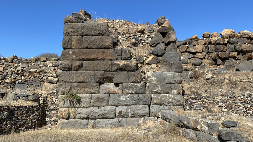
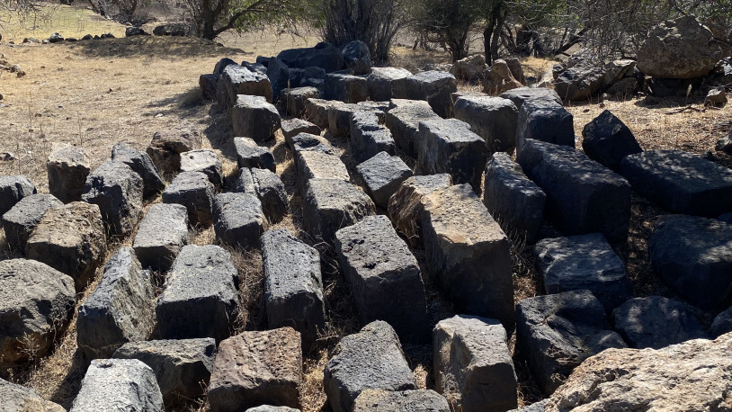
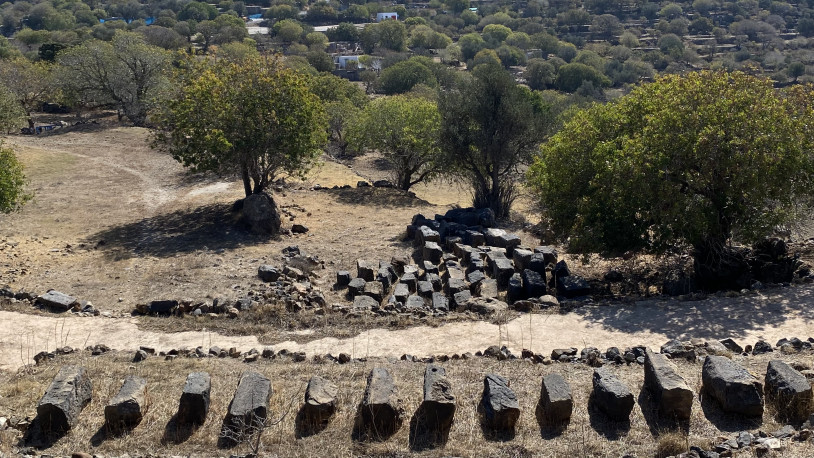
Many centuries later, one of the eastern towers had lost much of its structure. The rock beneath it had deteriorated, causing the lower blocks to slide down the slope. Those above had followed. Some stones lay heaped at the foot of the walls, others had rolled farther away, while still others had gradually disappeared beneath the earth.
At the beginning of the twenty-first century, 110 blocks were recovered during restoration work.
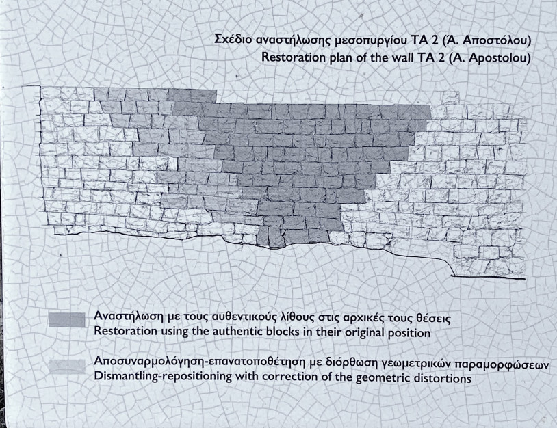
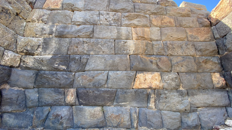
Bringing them back up the hill was not enough. The restorers had to work out where each stone had originally belonged, matching one surface to another, tracing the continuation of a cut, looking for the point where two edges met. Sometimes a small recess was enough to bring stones back together after centuries apart. At other times, the edges were too worn, the fractures too numerous, and no arrangement could establish their original positions with certainty.
Eighty-three blocks found their way back into the wall.
The original positions of the remaining twenty-seven could not be established.
Cranes and electric hoists were used to lift the stones. For the final adjustments, needed to bring the surfaces into alignment, the restorers also used levers inserted into recesses left by the ancient builders. More than two thousand years later, those small openings could still serve the same purpose.
The underlying rock, however, could no longer support the tower. Its foundations had to be reinforced with reinforced concrete and stainless steel.
Among the scattered blocks, the archaeologists were searching for one whose position was unknown, although they knew the letters it had once carried.
A fourth-century BC Greek inscription ran across the tower and the adjoining wall, declaring a strip of land five feet wide along the fortification to be public property. The words extended across several blocks, but the last one, bearing the end of the inscription, had disappeared.
They searched for it even among the ancient stones reused in the retaining walls of nearby fields.
They did not find it.
What was missing were the final two letters, ΟΣ, of the word τείχεος, ‘of the wall’.
A new stone was set in its place.
Note: The documentation includes notes and materials gathered through field research, meetings and conversations with local residents, alongside bibliographic research and further reading, together with photographs taken during the study trip to Greece between mid-September and 7 November 2021.
The materials presented document an ongoing research process and form part of an evolving archive, whose contents will continue to be expanded, developed and revised until the completion of the final artwork, scheduled for autumn 2028.